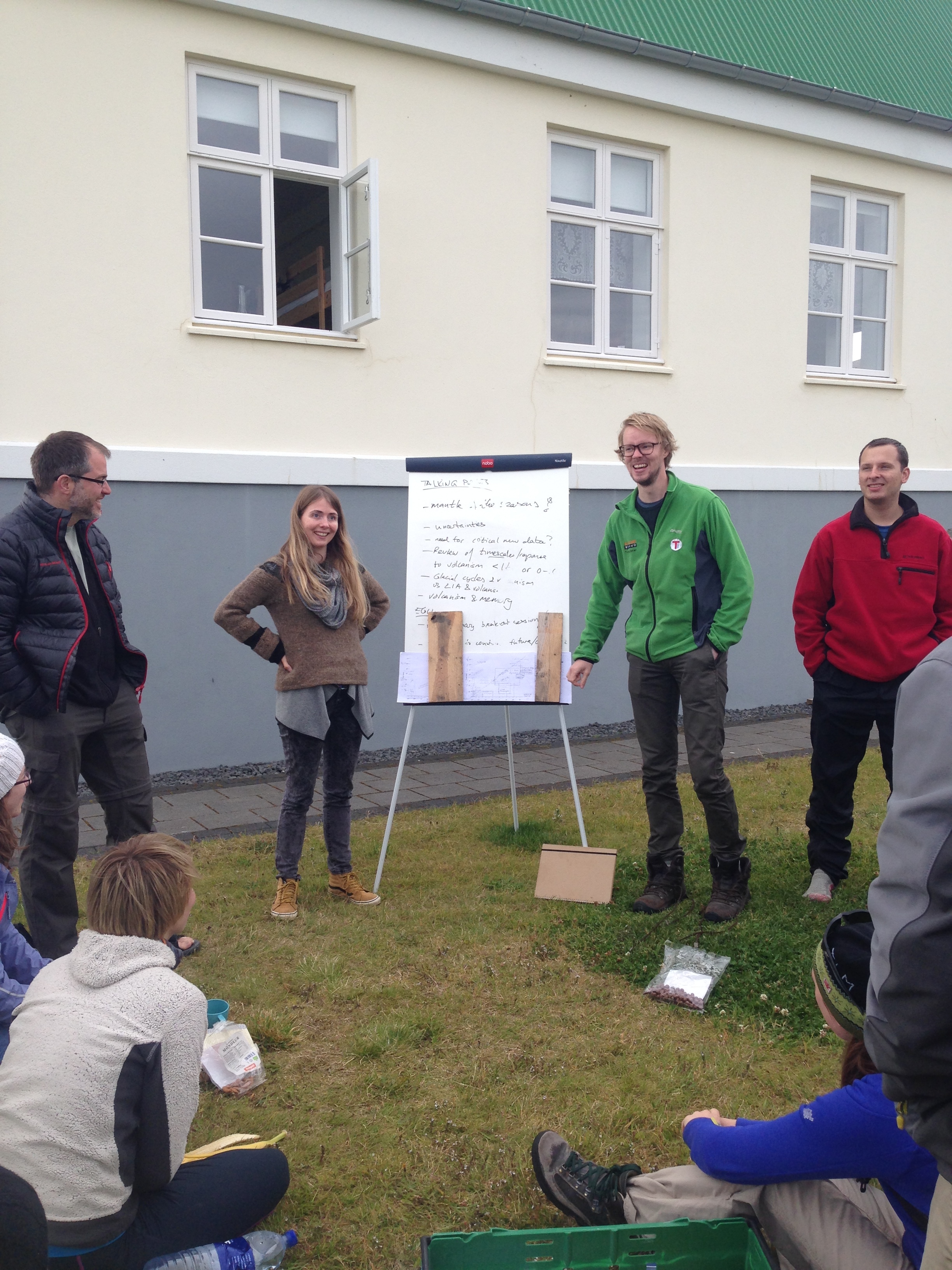
30 eager European and US-based PhD students and PostDocs joined some 10 lecturers in Laugarvatn, Iceland, to spend two weeks together delving into this year’s topic ”Climate and Volcanism”.
Student-led summary of key aspects of this year’s topic Climate and Volcanism. Photo by Daniel McCoy
The diverse background of the lecturers and students reflected the interdisciplinary nature of the topic, bringing together atmospheric science, aerosol chemistry and physics, geology, glaciology, oceanography and paleoclimate.
The most challenging but exciting aspect of the theme proved to be linking the wide range of time scales involved, from Earth’s mantle processes, via the glacial cycles and mid-ocean ridge volcanism to the rapid sequence of events following a single volcanic eruption.
When not listening and discussing the latest scientific buzz about how volcanoes affect climate and vice versa (!), students were working hard on group projects on tephra, lake sediments, mid-ocean ridges and sea level, causality and volcanic aerosols.
Eager inspection of a section of volcanic ash deposits. Photo: Henning Åkesson
The two weeks were blessed by unbelievably good weather. This provided great conditions for several field excursions around central and southern Iceland, including vast lava fields, natural hot springs and glaciers.
Snow scooter excursion to learn how to measure surface energy balance, mass balance and glacier motion at the ice cap Myrdalsjökull. Photo: Henning Åkesson
We are happy to announce that yet another PhD position is available within the ice2ice project.
The candidate will work within the fields of global climate modeling. The focus will be on Arctic interactions between atmosphere, sea ice, and ocean and their possible control on the Greenland Ice Sheet. Both present-day, palaeoclimatic and future climate states will be central to the work. The work will contribute to further development of the EC-Earth state-of-the-art Earth System Model. In particular, the aim is to study the role of changes in sea-ice conditions as a controlling mechanism for the state of the Greenland Ice Sheet.
The successful applicant will be enrolled at the University of Copenhagen and take part in scientific activities both at the Centre for Ice and Climate and DMI. In addition to working on the research project, publications, and PhD thesis, the candidate must take PhD courses, participate in congresses, and participate in teaching and dissemination activities. The position involves a stay at an external research institution for a few months, preferably abroad.
The ideal candidate has experience with climate dynamics and modelling (preferably global climate modelling or modelling sea-ice–ocean–atmosphere interactions). Experience with programming in FORTRAN/UNIX and knowledge about HPC computing is also a large advantage.
More information on the position and how to apply is available here.
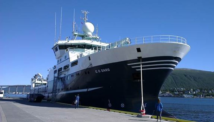
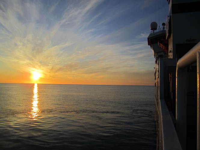
The Norwegian research vessel G.O. Sars after arriving in Tromsø with more than 200 m of sediment cores to document past abrupt climate change. Photo credit: Iben Koldtoft
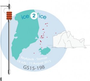
Going on a cruise for a month sounds tempting for most people and that is exactly how I spent one month of my summer. Instead of sunshine and 25 degrees, the temperature was closer to the freezing point on the thermometer and normal summer weather was replaced by milder weather conditions. The destination of the cruise was the western Nordic Sea and the east Greenland Margin. The ice2ice cruise was not a regular cruise, but a scientific cruise, starting in Reykjavik then heading towards the east coast of Greenland and ending in Tromsø, Northern Norway. Without the option to go ashore and far away from civilization, I spent four weeks aboard the Norwegian RV G.O. Sars. When I came home from the middle of the ocean, I realized that I had been part of a unique project
The ice2ice cruise logo, where the red dots indicate the more than 30 sites of coring marine sediments under the ice2ice cruise. Photo credit: Amandine Tisserand
Why are climate scientists going on a cruise?
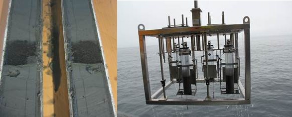
The purpose of the cruise was to collect marine sediment cores in the western Nordic Seas and along the east Greenland Margin. The retrieved sediments can be used to document abrupt changes in sea ice cover and ocean circulation along the East Greenland continental margin, during glacial times and for the more recent past. For this purpose three different sediment coring systems were used. The multicore, which samples sediments, including the sediment/water interface at the sea floor, the gravity core that is used to get information about the deeper marine sediments (up to 5 meter), and the calypso core that could retrieve up to 20 m long sediment cores, containing muddy sediments from the ocean floor to the ship’s deck.
One of the main questions of the ice2ice project is why there are abrupt climate changes. The sediment cores should be ideal for correlation to the RECAP (http://recap.nbi.ku.dk/) ice core from Renland Ice Cap in Eastern Greenland, drilled earlier this year. Together it is a unique material, which hopefully can bring information of the sea ice cover and its extent back in time.
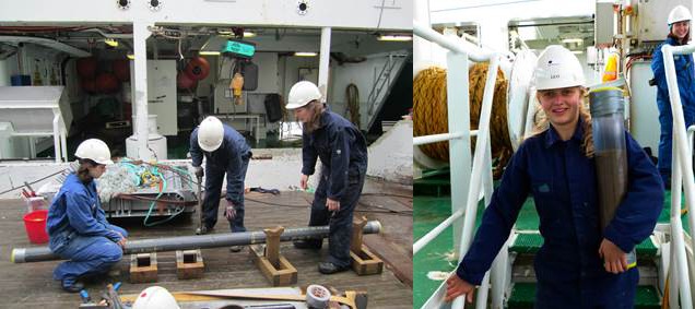
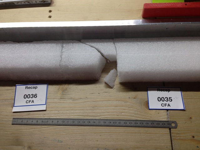
Sediments: a split calypso core showing a clear pattern of a tephra layer from a volcanic eruption (left), and the multicore on the way up with four successful sediment cores (right). Photo credit: Iben Koldtoft and Ida Synnøve Olsen.
When everything is new – also the type of cruise
This was my first cruise ever, and before I boarded the ship in Reykjavik in mid-July, my knowledge of marine sediments and the ocean was very limited. Most of the people on board the ship were geologists who knew a lot about sediments from the ocean and had been on cruises before. Now a month later, my knowledge about sediments and the life aboard a research ship has become much larger. I think I had the steepest possible learning curve about sediments, because there were no stupid questions to ask, and everyone was very nice about answering questions, even if it was outside their area. Usually I work with ice cores and modelling of glacier ice and for me everything was new. This meant that I could contribute with knowledge about the RECAP ice core instead. Now I can take part in a conversation about sediments together with other geologist.
Normally when going on a cruise, there are only a few scientists on board on the ship. This means that there is only time to core the sediments and cut them into sections, while all the scientific work takes places later, when the sediments are in the lab. On this cruise, as something new, we were several scientists, so when the sediments were on deck, we immediately did a splendid job of handling the cores, describing and analysing the material. Thus, the detailed lab analyses can start right away after the material gets back to Bergen.
Shipboard analyses indicated that the material we have brought back to the laboratories in Bergen covers a time span from the present and probably a few hundred thousand years back in time. Not all the data have been analysed yet but we are looking forward to start and we are eager to see the results.
Midnight sun over the Greenland Sea. Photo credit: Dag Inge Blindheim.
The science
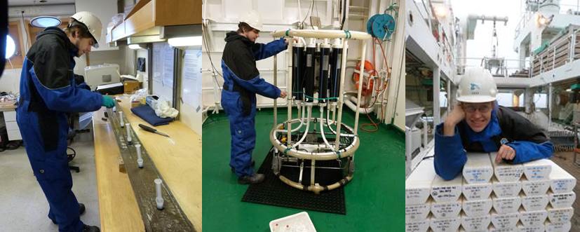
During the one month long cruise, we had collected numerous samples of shells from the ocean floor from 32 stations west of Iceland. We did CTD (Conductivity, Temperature and Depth) measurements, to get information about how the temperature, salinity, density and oxygen content of the water vary in the ocean, and we collected water samples at different depths to analyse oxygen and carbon isotopes. We also collected sediments from 31 stations and every core has passed the DNA sampling, color and MS measurements stations. The cores were then cut into sections, split down through the middle, logged and described so that we could get an initial feel for the quality and utility of the samples we retrieved, before they are brought to shore for much more detailed analysis.
Ashley, Margit and Ida cut a gravity core into sections (left), while Alby brings a multicore from the deck down to the lab (right). Photo credit: Dag Inge Blindheim and Kerstin Perner
Working 24-hour shifts on the ship meant that we achieved a lot and we brought home more than 200 m of muddy sediment cores from the sea floor from the western Nordic Seas and the east Greenland Margin and more than 190 water samples.
Henrik is taking DNA samples of a gravity core (left) and water samples from the CTD (middle). Photo credit: Iben Koldtoft. I am happy after having packed one of the last sediment sections, which is now ready to be sent to Bergen and further analyzed (right). Photo credit: Kerstin Perner
Although it was 12 hours of hard work most of the days, it was a pleasure to be part of the cruise. It has certainly not been my last cruise, if it is up to me, and I will look forward to a new cruise if I am lucky enough to get the chance. Weather was nice most of the time, but of course, we had some days of rough seas. The professionalism of the crew of G.O. Sars created an excellent atmosphere for work and time off, it was more like being on a real 4 star cruise if we ignore the time we worked.
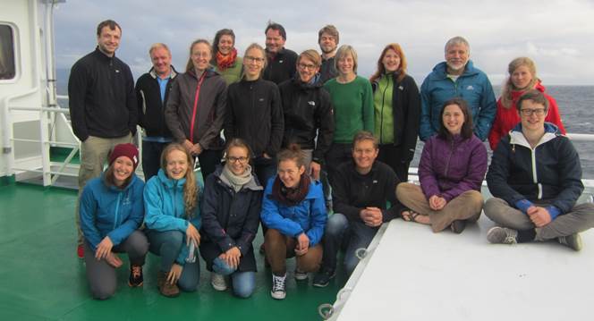
On the ice2ice cruise the scientists were Eystein, Carin, Jørund, Dag Inge, Bjørg, Christian, Margit, and Amandine from Uni Research (Uni Research Climate, Norway), Stig, Sarah, Evangeline, Henrik, Ashley, and Ida from UiB (University of Bergen, Norway), Flor from GEUS (Geological Survey of Denmark and Greenland, Denmark), Mads from CIC (Centre for Ice and Climate, Denmark), Kerstin from IOW (Leibniz Institute for Baltic Sea Research Warnemünde, Germany), Albertine from Bris. (University of Bristol, UK), and myself Iben from DMI & CIC (Danish Meteorological Institute & Centre for Ice and Climate, Denmark). We were 19 participants, 8 men and 11 women, representing 8 different nationalities, and supported by a ship crew of 15. We were in good spirits all the time and a successful cruise!
The scientific crew of the ice2ice cruise. Photo credit: Iben Koldtoft
The cruise would not be possible without support from the European Research Council Synergy project ice2ice (Danish-Norwegian), Bjerknes Centre for Climate Research (Norway) and Institute of Marine Research (Norway), who provided research vessel and crew onboard.
You can read more about the ice2ice project on this homepage.
A 20 meter long calypso core on the way from the sea floor to the ship’s deck. Photo credit: Iben Koldtoft
Iben Koldtoftis PhD student within the ice2ice project at Danish Meteorological Institute and Centre for Ice and Climate, University of Copenhagen, Denmark and supervised by Jens H. Christensen and Christine S. Hvidberg. She is interested in modelling the dynamics of the Greenland Ice Sheet and the smaller glacier, Renland Ice Cap, in the Scoresbysund Fjord, Eastern Greenland. Currently she is coupling the ice sheet model PISM to the ocean by implementation of calving to the model. Surface mass balance simulations of the Greenland Ice Sheet will later be used to assess the quality of the interaction between the ice sheet model and a climate model in comparison to observations.
Hard working, but happy, ice2ice members in the cold freezer.
Ice2ice members Bo Vinther, Paul Vallelonga and Thomas Blunier started a trip to collaborators at Alfred Wegener Institute (AWI), Bremerhaven, Germany from Copenhagen, Denmark on sunday with a car full of labelled plastic bags.
The plastic bags are used for the multiple pieces of the 584.11 m of Renland ice core. The ice core was already cut into 55 cm pieces while still in Greenland, but are now further being split into sections for different measurements. The cutting takes place at AWI and not in Copenhagen as they at AWI has a freezer set up for exactly such work.
Further Di-electrical profiling (DEP) of the ice can be done there. DEP inform on the electrical properties of the ice. Also preliminary scrapings of the ice core sections are being taken to inform on the temperatures of the past climate as determined by water isotopes and thus help to make a quick constrain on the ages of the Renland ice core.
The cutting of the Renland ice core will continue the next 3 weeks and more ice2ice participants will join the processing.
While most of the ice is in good condition, some sections have been influenced by the long transport from Greenland to Germany.
An international research team led by partner institute in ice2ice; the Niels Bohr Institute at the University of Copenhagen have drilled an ice core through the ice cap on the Renland peninsula in the Scoresbysund fjord in Eastern Greenland in record time. The climate on Renland is strongly influenced by the sea ice along the east coast of Greenland and the ice core can probably tell us about past climate fluctuations in the Arctic Ocean more than 100,000 years back in time.
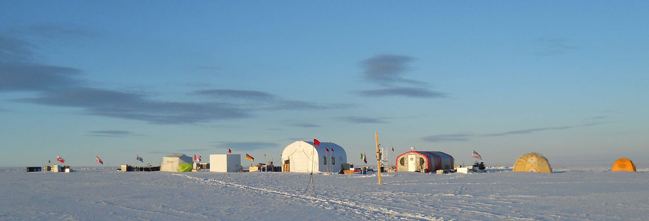
The camp at Renland seen in the midnight sun. From left to right are the generator tent, the ice core freezer, the drilling tent, the kitchen and living tent and then the medical tent and yellow residential tents.
The Arctic sea ice is undergoing rapid change. The prevalence of permanent sea ice in the Arctic has been 30-50 percent less over the past 35 years. So the question is whether the Arctic sea ice will disappear in a future with global warming as it did in the North Atlantic several times during the last ice age. This could be crucial for the climate of most of the northern hemisphere. The new international RECAP ice core drilling (REnland ice CAP project) on Renland could contribute to a better understanding of future climate by revealing past climate fluctuations.
The ice’s knowledge about the climate
The ice is formed from snow that falls and remains from year to year and is gradually compressed into ice. There is a lot of precipitation on Renland and about 1½ meters of snow fall annually. The ice itself is about 600 meters thick, but still retains the ice layer that is more than 100,000 years old. This is due to its location, as the ice lies on a plateau at a height of about 2,000 meters surrounded by mountains. In late April and early May, a research team from the Niels Bohr Institute selected the exact location of the drilling site using radar measurements, which they did on the ice cap with radar equipment from CReSIS (Center for Remote Sensing of Ice Sheets), University of Kansas. The criteria for selecting the drilling site was to find a place where the inner layers of the ice cap are parallel and are as undisturbed as possible, so they could get information far back in time.
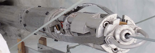
The Ice core drill can take cores of up to two meters.
Then the drilling equipment and crew were flown to the drilling site. First they flew with the American Hercules plane from Kangerlussuaq to Mestervig in Eastern Greenland and from there to the drilling site on Renland with the smaller AWI Bassler DC-3 fly, which can also land on the ice with skis. In addition, heavy goods were already shipped to Constable Pynt in Eastern Greenland last year and flown onto the ice from there.
By the middle of May, the drilling had already started. They work at night when the temperature is colder so that the ice cores do not risk getting too hot when they come up to the surface. The international RECAP ice core drilling was completed at 02:00 Danish time, Friday, June 12. At a depth of 584.11 meters, the ice core drill hit the ground under the ice.
Drilled in record time
Chief driller at RECAP, Trevor Popp, an ice core researcher at the Niels Bohr Institute, says: “It is a great relief that we have now managed to reach ground after a month of drilling here at Renland. We have reached our goal a whole week before planned thanks to a strong international team and one of the world’s best ice core drills, developed in part by engineering assistant Steffen Bo Hansen, ice core researcher Sigfús Johnsen and engineer Simon Sheldon – all from the Niels Bohr Institute and the drill was partially manufactured at the institute’s workshop.”
The deepest ice core from the Renland drilling displayed proudly by the international research team that was in the camp when ground was reached.
Preliminary analyses of the new ice cores show that the ice is very old, likely to be significantly older than 100,000 years. The ice core certainly contains ice from both the last ice age and from the warm interglacial period, the Eemian, which was before the last ice age.
“The ice on Renland is particularly interesting to study because of its location on the coast of Eastern Greenland, where the climate is influenced by the Arctic sea ice that drifts down along the coast. The prevalence of the sea ice is closely linked to climate change and we can therefore study past climate changes in the old ice from Renland,” explains scientific head Bo Møllesøe Vinther, Niels Bohr Institute.
“Measurements of the temperature down through the 584.11 m deep bore hole already show us that the climate on Renland has been significantly warmer during the past 20-30 years as the sea ice has retreated back into the Arctic Ocean,” adds Primary Investigator on the ice2ice project Bo Møllesøe Vinther.
Traces of past life
After the ice core drill reached the bottom, the team drilled down into the sediment to get samples of what lay underneath, which is older than the ice. Here you might find traces of past flora and fauna on Renland from before the ice cap formed.
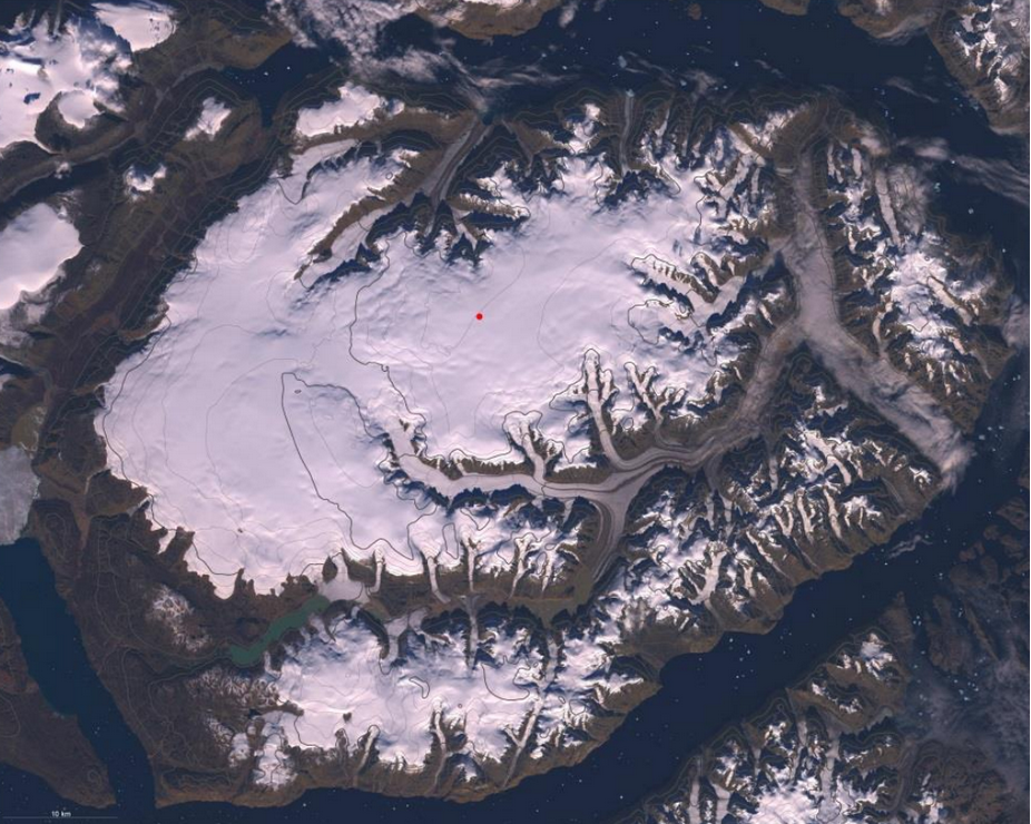
The peninsula Renland in Scoresbysundfjorden in East Greenland.
A total of 19 researchers from 8 nations have been in the field on the Renland ice cap since the end of April, quite a few were part of the ice2ice project. RECAP is financed in part through a Sapere Aude grant of 7 million kroner from the Danish Council for Independent Research and through grants from the Alfred Wegener Institute (AWI, Bremerhaven, Germany), from the National Science Foundation in the United States and from Ca´ Foscari, IDEP University of Venice (Italy).
In the coming week, the RECAP camp will be packed up and the ice core samples will be sent to laboratories at the Niels Bohr Institute, University of Venice, Penn State University and the University of Colorado, where a wide range of scientific analyses will be carried out over the autumn and winter.
“That we have been able to locate a drilling site, build a camp and complete a nearly 6000 meter deep drilling of both ice and drill material in just over two months is really an achievement that our team here at the institute can be proud of,” assesses field leader for the first half of the project, associate professor and centre coordinator Sune Olander Rasmussen.
This story was originally posted at the NBI homepage by Gertie Skaarup.
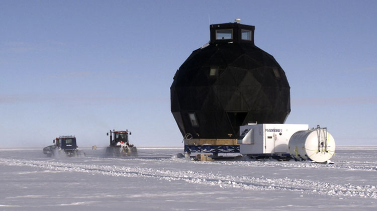
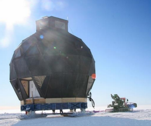
The entire Greenland station NEEM has been moved 465 km across the Greenland ice sheet to its new position at the North East Greenland ice stream. Here the dome will facilitate a new deep drilling to investigate fast flowing ice and work as a port for scientific projects in the Arctic-ice2ice staff joined the relocation.
The 14-meter high building, the ‘Dome’, weighing 47 tons, is on skis and is being pulled across the snow by two tracked vehicles.
“We arrived at the EGRIP position at 16:00 today. We stopped just outside the camp area to survey the camp before placing the Dome and raising the garage tents. We happy and relieved that this crazy plan to pull the huge Dome across the ice succeeded. We feel like modern pioneers,” explains Jørgen Peder Steffensen, ice core researcher and field leader, Centre for Ice and Climate, Niels Bohr Institute, University of Copenhagen.
Fast flowing ice
The project involves drilling a 2½ kilometer deep ice core through the fast flowing part of the ice sheet. The drilling will be carried out in the large ice stream in Northeast Greenland. An ice stream is an area in the ice where the ice is flowing around 60 meters per year.
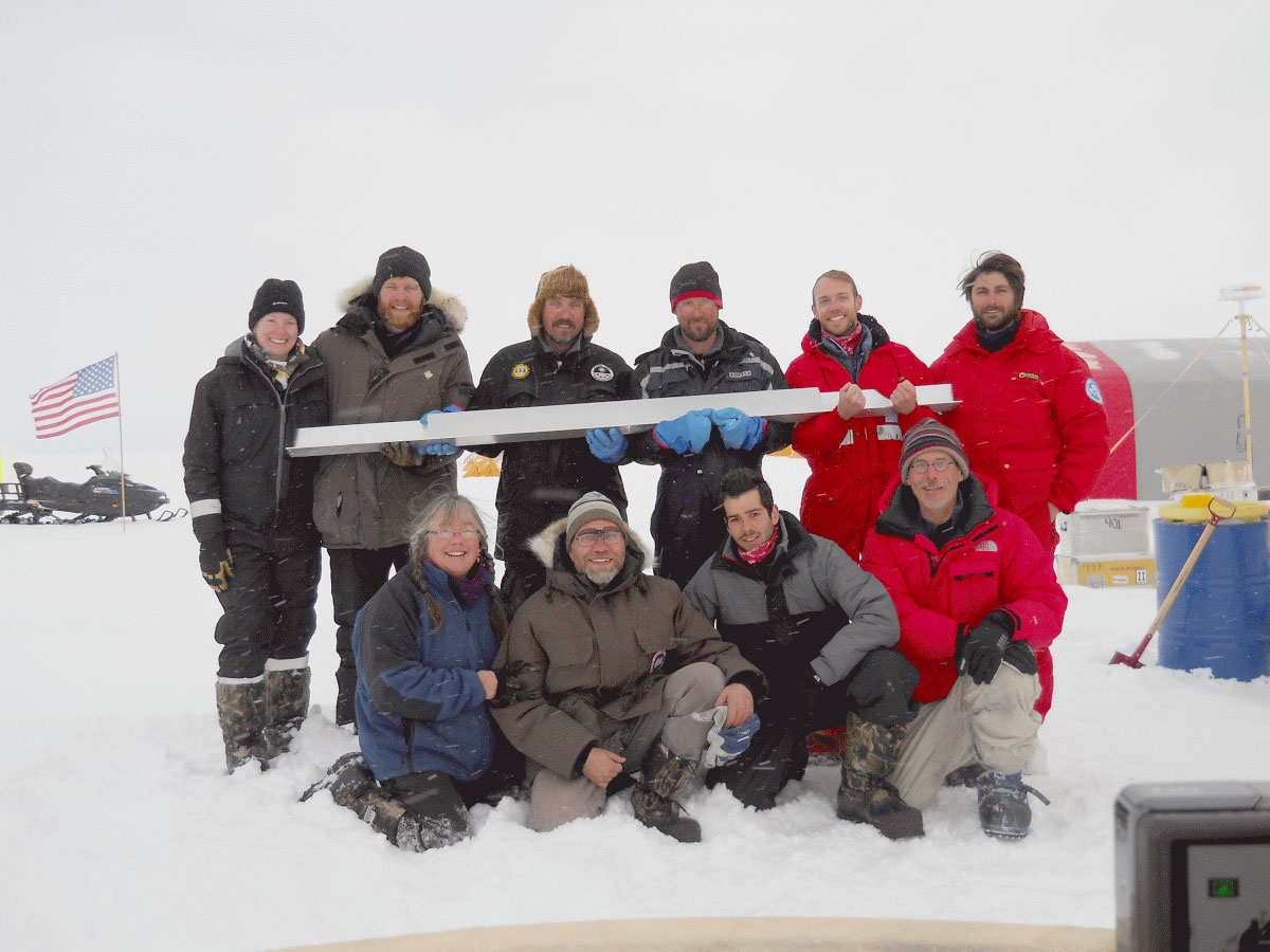
Here they have reached EGRIP and the flag is placed where the centre of the camp will be located.
Little is known about how the ice in the ice sheet moves, so the aim of the project is to gain more knowledge about how ice streams are contributing to the rapidly increasing loss of the Greenland ice sheet. Knowledge about how and how fast the ice is moving could improve forecasts of sea level rise in the coming years.
Buildings on skis
The EGRIP camp was planned as a mobile infrastructure where all of the buildings are on skis. Compared with bases on the ice in Antarctica, EGRIP is a very innovative way of having a base on the ice, which meets all of the requirements for the environment. Snow is deposited on the ice each year, so the buildings on the ice slowly ‘drown’. Bases on the ice thus have a relatively short lifespan.
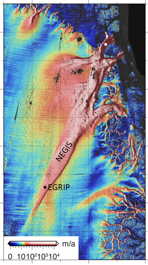
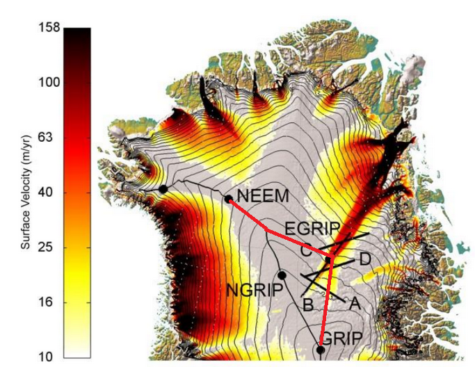
The new drilling will take place in the large ice stream in Northeast Greenland. The ice stream begins near the peak of the ice sheet and stretches out to the coast, where it splits into three large ice streams. The surface velocity of the ice is shown with colour. The dark colour flows more than 150 meters a year.
The EGRIP buildings will not disappear in the snow because they are mobile and can be pulled up on the new snow surface periodically. The main building is a 14-meter high ‘Dome’, weighing 47 tons. The Dome and 11 large sleds with a combined weight of 150 tons was pulled by five tracked vehicles from the old camp NEEM to EGRIP from 18-26 May.
“Never before has an entire camp been pulled so far across the ice and we are very proud that it was possible. It was like pulling our own snail shell over the ice. Every evening the 11 participants could eat and sleep in the large, well-equipped Dome,” says Jørgen Peder Steffensen.
Now they are looking forward to setting up the camp and starting the deep drilling next year.
The project would not be possible without support from the A.P. Møller Foundation, University of Copenhagen, the Alfred Wegener Institute (Germany), Bjerkness Centre (Norway) and the National Science Foundation (USA), who provided staff and a tracked vehicle.
This story was originally posted at the NBI homepage by Gertie Skaarup.
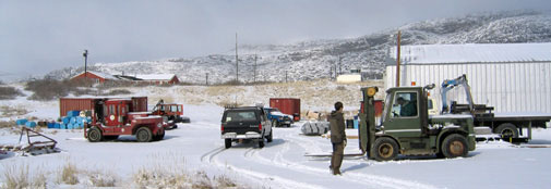
Kangerlussuaq is the base for much of the research done on Greenland
ice2ice scientists from NBI are involved in two ice coring campaigns this year; the ReCAP project and the NEEM to EastGRIP traverse. The first people flew into Kangerlussuaq, East Greenland on Monday the 20th. More will follow tomorrow; Friday 24th April-2015. The last people will leave Greenland the 3rd of July.
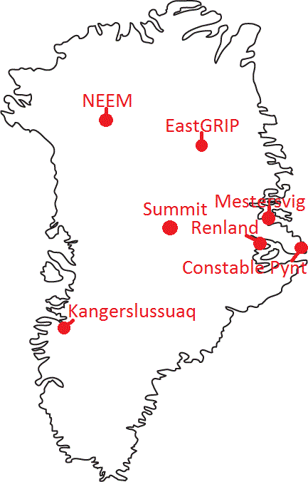
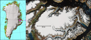
The Renland ice cap. The dot marks the camp position.
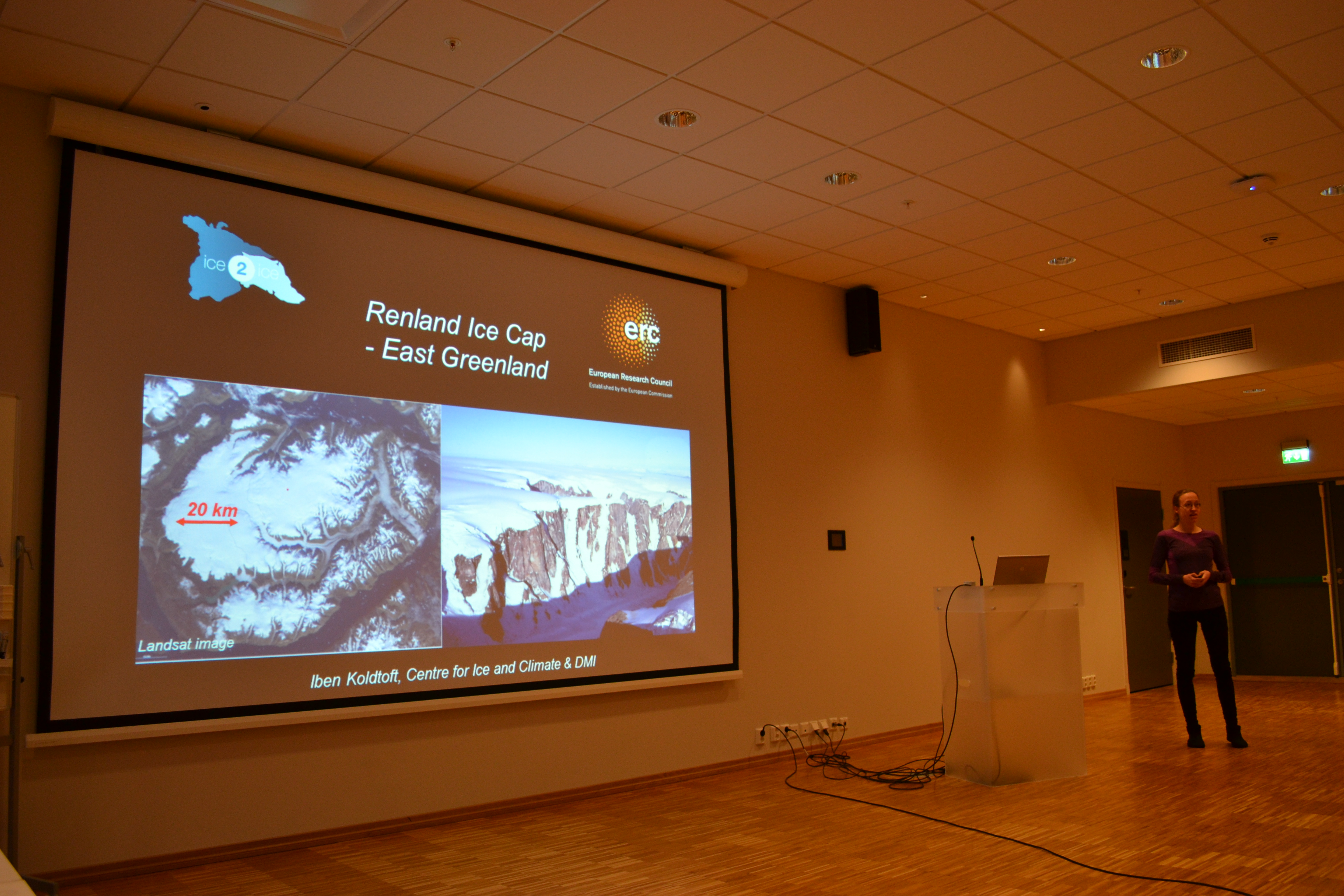
The Renland ice cap is situated in Eastern Greenland on a high elevation plateau on the Renland peninsula in the Scoresbysund fjord (see Figure). Climatic conditions on the Renland ice cap are strongly influenced by the varying Arctic sea ice export along Greenland’s east coast. An ice core from the Renland ice cap is thus perfectly suited for obtaining information on Eastern Greenland climatic conditions including the export of sea ice from the Arctic Ocean for the past 100,000 years. We therefore propose the REnland ice CAP project (RECAP).
The overall purpose is to support a drilling to bedrock on Renland ice cap (to approx. 500 m depth), to support basic ice core processing on site, to support a firn air pumping and shallow ice coring operation, to support a pre-site radar survey and to support testing of new ice drilling technologies. These activities require a field camp with 11 persons over a period of 2 months. Renland ice cap is not easily accessible. LC-130 cannot land on this small ice cap so the bulk of the air lift to the ice cap occurs through a collaboration with German Alfred Wegener Institute (AWI) who have put a Basler ski-equipped air craft to the disposition of RECAP in three periods (around put-in, around mid-season crew exchange and around the pull-out). The Basler will operate out of the civilian airport of Constable Pynt (Nerlerit Inaat or CNP), which is the airport of Scoresbysund (Itoqqortormiit) and Mestersvig (MST), which is an abandoned mining town, now operated by the Danish military in the NE-Greenland National Park.
The ReCAP project is split into three phases:
Late April to early May: Radar measurements with CRESIS surface radar, establish skiway (4 crew).
Early May to end of May: Establish main camp, deep drilling an ice core to bedrock and firn gas project (11 crew).
Beginning of June to late June: Continuing the deep drilling, testing rapid access drill and take down camp (11 crew).
The logistic operations in RECAP will follow these steps:
Two persons deploy to Constable Pynt by commercial plane to unpack cargo there and make it ready for shipment.
The rest of the put-in crew and East coast FOM will fly to Mestersvig by 109th C-130 along with cargo (tents, weatherports, drills, food, etc.).
A group of four persons will fly to Renland Ice cap (either by helicopter or Twin Otter) for site survey using Kansas radar. In about three days the optimal drilling site should be identified and camp put-in can occur using the Basler from both Constable Pynt and Mestersvig. Two radar operators return to Constable Pynt. At Mestersvig a freezer will be built to keep ice cores from Renland cold.
RECAP camp construction will progress while the Basler finishes deployment of people and equipment.
Drilling processing and sampling and firn air program.
Mid-season crew exchange will occur by Basler to Constable Pynt.
Drilling processing and sampling and rapid access drill test.
During pull-out, the Basler will shuttle cargo to Constable Pyntfor stowing into containers bound for Kangerlussuaq and passengers, ice cores and other equipment to Mestersvig.
Passengers, ice cores, and all equipment in Mestersvig is picked up by C-130 in two (possibly three) C-130 flights to Kangerlussuaq.
The route of the traverse is marked with the red line. The colorbar indicate the surface velocity. Notice the East Greenland Ice Stream, which is subject for the EastGRIP deep drilling project.
In North East Greenland, the biggest ice stream in Greenland begins right at the central ice divide and cuts through the ice sheet in a wedge shape to feed into the ocean through three large ice streams (Nioghalvfjerds isstrømmen, Zachariae isbræ and Storstrømmen). The onset of the ice stream on the ice divide is believed to be caused by strong melting at the base and the ice reaches velocities over 100 m/yr 200 km from the ice divide, but still 500 km from the coast where the ice is heavily crevassed. Center for Ice and Climate , NBI, University of Copenhagen have been granted money to do a large drilling at this exciting site.
The large dome will be pulled more than 380 km from NEEM ice core drilling site to the new ice core drillling site EastGRIP.
This May all the equipment must be pulled to EGRIP and the main purpose for this years field campaign on the central ice sheet is to move the equipment. Currently the main part of the equipment needed to establish the camp at EastGRIP is stored at the previous deep drilling site NEEM, 380 km West-Northwest of EGRIP. The main building, the Dome was put on skis in 2011 to enable surface transport to the new site. All the remaining equipment is stored on sledges at NEEM.
The Traverse will thus start at the NEEM ice core site at move the 380 km to the North west of Greenland. Part of the group will further continue up to the American ice core camp Summit.
During the traverse as much science as possible will be performed including:
Deep borehole logging at NEEM
Strain net and GPS measurements to determine ice flow
Radar measurements to follow layers between NEEM, EastGRIP and Summit
Drilling of 5 shallow cores to investigate anthropogenic impact in the far north and resolve the impact of sea ice on impurities and water isotopes.
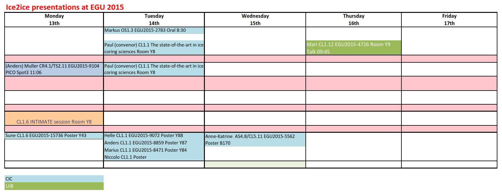
ice2ice is well represented at this years European Geophysical Union (EGU) meeting occurring right now in Vienna, Austria. The titles from the ice2ice community are diverse and examples of the presented posters and talks include:
The Renland ice cap is situated in Eastern Greenland on a high elevation plateau on the Renland peninsula in the Scoresbysund fjord.
Climatic conditions on the Renland ice cap are strongly influenced by the varying Arctic sea ice export along Greenland’s east coast. An ice core from the Renland ice cap is thus perfectly suited for obtaining information on Eastern Greenland climatic conditions including the export of sea ice from the Arctic Ocean for the past 100,000 years.
The RECAP ice core drilled to bedrock will be the backbone of a coordinated science program between Denmark, Germany and the U.S. The shallowness of the Renland ice cap furthermore assures that it does not have a brittle ice zone in the Holocene ice like the Greenland ice sheet. The RECAP ice core can therefore yield the first continuous Holocene profiles of gasses and chemical impurities extracted from Greenland. More information on the RECAP project can be found here.
Strong affiliation with ice2ice
The main goal of the RECAP project is to retrieve and analyze a high quality ice core from the Renland ice cap, drilled all the way to bedrock. A 7 mill. kr Sapere Aude grant from the Danish Research Council to Associate Professor Bo M. Vinther, who is also a PI in the ice2ice project, funds the Danish contribution to RECAP. The US National Science Foundation and the Alfred Wegener Institute provide air support for RECAP, while the project logistics and drilling is managed by the Centre for Ice and Climate, Denmark
While the project is not directly part of ice2ice the RECAP project will enhance the outcome of ice2ice beacuse the proximity of the ice core to the Arctic ocean and the sea ice edge will enhance our knowledge on past sea ice concentrations. Further ice2ice NBI participants also participate in the RECAP project also primary investigator of the RECAP project is Bo M. Vinther who is also a PI in the ice2ice project.
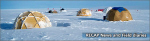
RECAP news and Field diaries
Field work will start in May 2015 and participants paid by the ice2ice project include: Niccolo Maffezioli (PhD), Iben Koldtoft (PhD), Christian Panton (PhD), Lars Berg Larsen (logistics), Bo M. Vinther (professor). You can keep updated with the field work in the diaries from the RECAP project.
A total of 64 participants attended the Nordheimsund workshop which took place January 26th to 29th, 2015 in Nordheimsund, Norway.
The meeting gathered the ice2ice community and allowed for discussions and input on how to continue the project in the coming year.
In the first part of the meeting ice2ice scientists and invited speakers held no less than 30 talks. Further 10 short talks were given by PhD’s hired within or related to the ice2ice project.
The talks covered a vast majority of science related to the ice2ice project; sea ice proxies, total air content as a proxy for ice sheet elevation, field work that will take place in the coming year, uncertainties in climate models, adjoint method to produce a global ocean state estimation of the glacial ocean, Ice sheets in the climate system, dynamics of the Greenland Ice Sheet and discussion of current changes, Model of Arctic sea ice retreat effect on Greenland, the effect of laurentide icesheets on midlatitudes to just mention a few.
The talks formed the foundation for the work package discussions, which took part over the last two days of the meeting. Two discussions were ran at the time. This allowed for multidisciplinary input from the scientists. The discussions formed a work plan for the coming year including several minor multidisciplinary workshops, publication plans and input to the planned field work.